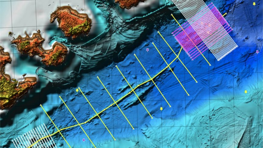
Between January 18 and February 4, 2019, 38 marine geophysics profiles were conducted to investigate the shallow structure of the crust around the Bransfield rift, with special interest in two submarines volcanoes: Orca, located 20 km south from King George Island, and Building A, an unnamed volcano located ~ 30 km east of Deception Island. The work was carried out with the participation not only researchers from BRAVOSEIS project, but also of a large group of UTM technicians to control the available technical means.
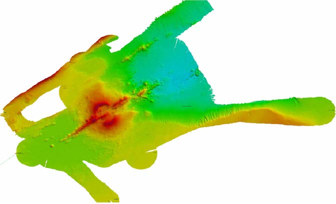
A complete geophysical study was performed with multi-beam echo sounder, magnetometer, multi-beam sonar and multichannel seismic reflection. Gravimetry data was also recorded throughout the campaign. A preliminar 3D image of the Orca volcano have been obtained from the bathymetry performed around the volcano (fig. 1 ).
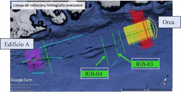
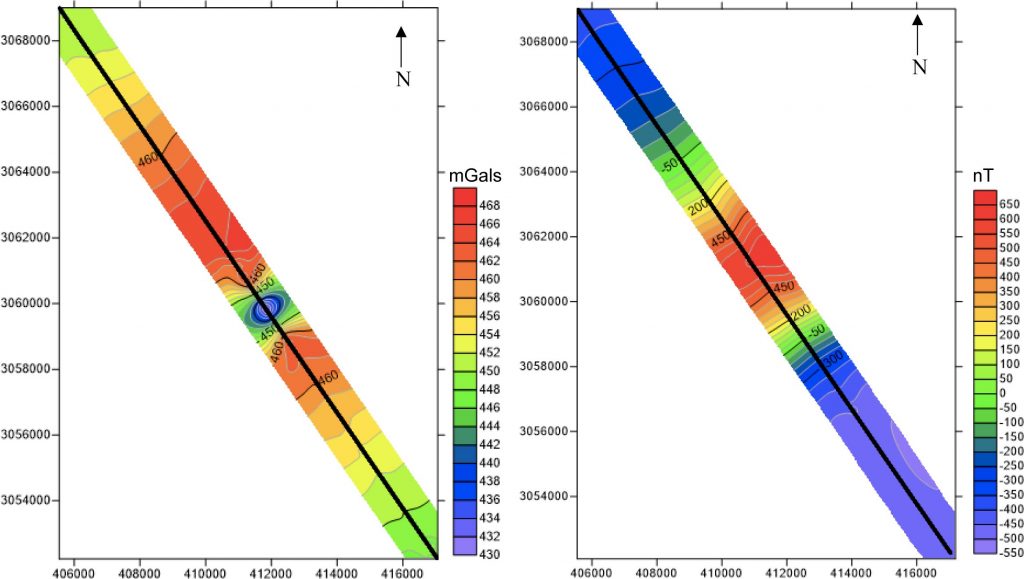
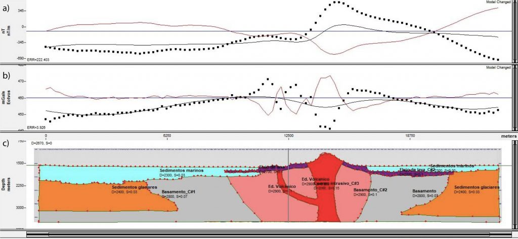
They have also been analysed seismic, magnetic and gravimetric data from two perpedicular profiles to the rift (rift-04 and rift-03, fig. 3), to obtain magnetic and Bouguer anomalies as well as 2D geophysical model. (fig. 4-5).
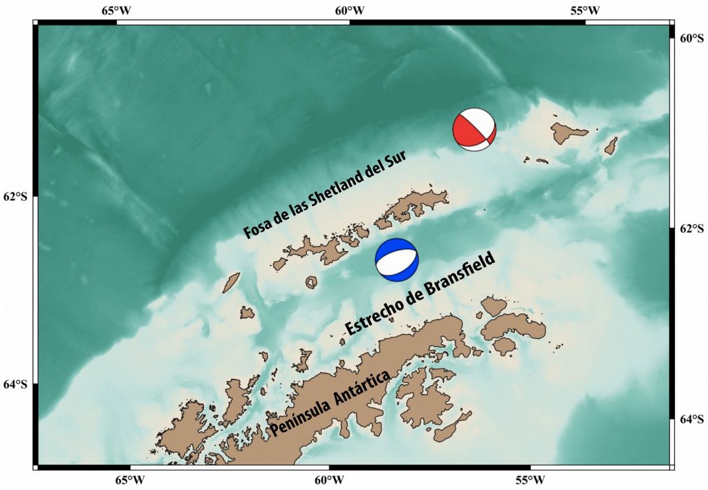
Seismicity data analyses (fig. 6) (Davoli, 2019) recording in land seismic station in the BRAVOSEIS project during 2018 and firts 2019 suggest a domain the extension tectonic regimen in the Bransfield Strait and compressive en the South Shetland Trench according to a scenario of rift opening and subduction (fig. 7).
E

Fig. 6 Preliminar locations for 2018 seismic data (seismic station in pink) (Davoli, 2019).
(Davoli, 2019)
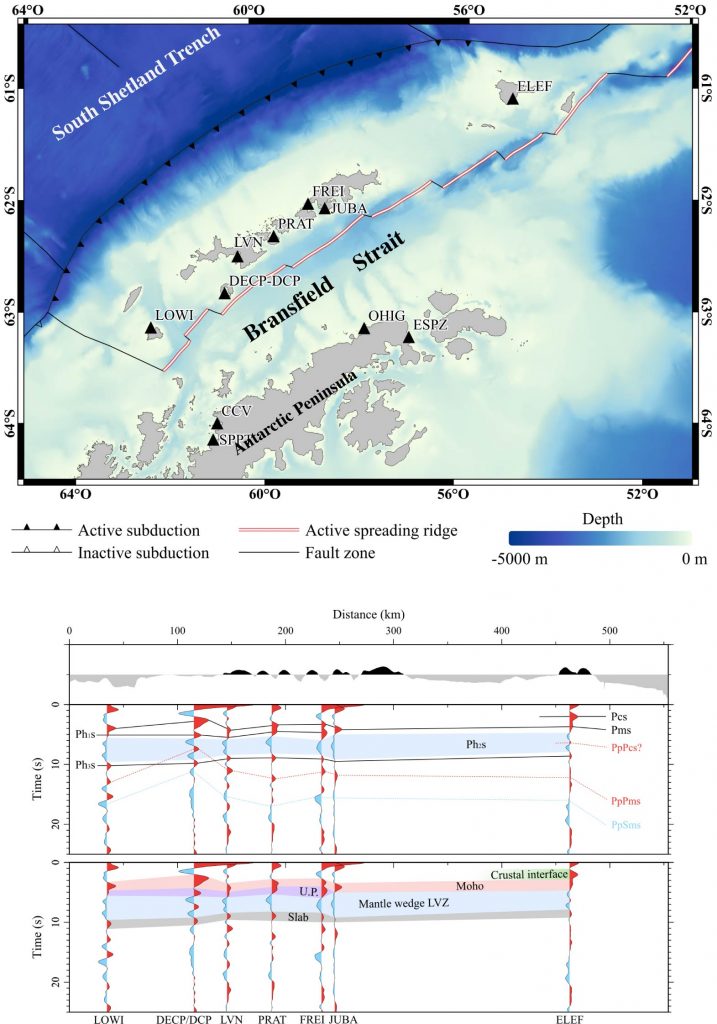
Receiver function of seismic station data recording in the South Shetland Island have also been analised to image the structure of the crust and upper mantle of Bransfield Strait (fig. 8) (Parera, 2019).
Bibliography
Álvarez Labari, Eugenia. Obtención de un módulo geofísico 2D utilizando datos marinos magnéticos, gravimétricos y sísmicos. Corte perpendicular al Estrecho de Bransfield (Antártida). Tesis del Máster de Geofísica y Meteorología. Universidad de Granada. Septiembre 2019
González, E., Ametller, R., Serrano, J.A., Sánchez, H., 2019. Informe técnico Campaña BRAVOSEIS.
Davoli, Roberto. Análisis de la sismicidad en el Estrecho de Bransfield (Antártida) durante el año 2018 y principios del año 2019. Tesis del Máster de Geofísica y Meteorología. Universidad de Granada. Septiembre 2019
Parera Portell, Joan A.. Structure of the crust and upper mantle beneath the Bransfield Strait (Antarctica) using P receiver functions. Tesis del Máster de Geofísica y Meteorología. Universidad de Granada. Septiembre 2019
Rodríguez Anta, Saray. Obtención de un módulo geofísico 2D utilizando datos marinos magnéticos, gravimétricos y sísmicos. Corte prependicular al Estrecho de Bransfield (Antártida). Tesis del Máster de Geofísica y Meteorología. Universidad de Granada. Septiembre 2019